Warming temps, elevated fire risk likely next week
Temps in the 80s, dry & windy conditions lead to fire danger next week.
The high pressure system sitting over the upper Midwest/Minnesota will continue to linger in the area through most of next week. This will lead to even warmer temperatures with highs rising into the 80s through this weekend and next week, as well as, an elevated fire danger risk due to the dry and windy conditions anticipated next week.
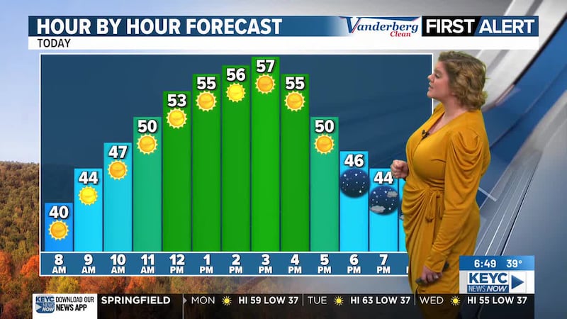
Today will be the coolest day in the forecast through the weekend and nearly all of next week, despite sunny skies spanning across the area. Temperatures will top out in the low=70s by this afternoon with light winds up to 10 mph mixed in. Tonight will remain clear and quiet, but cool as temperatures drop into the mid to upper-40s by Friday morning.
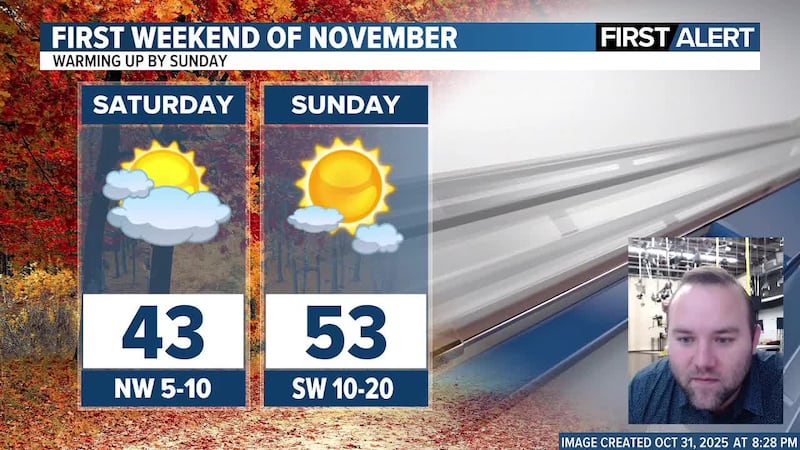
Sunshine will continue tomorrow through Sunday with increasing temperatures on the way. We are looking at low-80s returning to the area throughout tomorrow afternoon with winds remaining light up to 10 mph. A few clouds may bring in a stray shower or two to portions of the area late Friday night before skies return to being mostly clear for the overnight hours. The chance of rain is minimal with very little to no accumulation anticipated, should we see a stray shower or two in the area Friday evening/night. Temperatures following the minor cloud coverage and possible rain chance will drop into the mid-50s by Saturday morning.
Saturday and Sunday will continue with summerlike temperatures as winds become strong. Temperatures are projected to hover in the low-80s on Saturday but the upper-80s by Sunday afternoon. We are looking at an elevated fire risk through the weekend and next week due to the warmer temperatures, dry conditions, and increasing winds. Winds will remain light throughout Saturday up to 10 mph before increasing to between 15 and 25 mph by Sunday with gusts up to 35 mph at times. Overnight temperatures will also be on the warmer side, dropping into the upper-50s by Sunday morning and the low-60s by Monday morning.
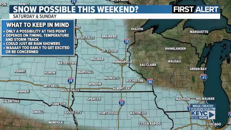
The weather pattern is finally going to shift through the middle of next week, this means we could see some more active weather return to the area by the middle of this month with the next system developing across the southwestern to south central portion of Canada. This will start to change the forecast by the end of next week with a minor rain chance and cooler temperatures on the way.
However, until the pattern shifts, we will continue to see sunshine and summerlike temperatures with the elevated fire risk through much of next week. This means we are looking at mostly sunny skies Monday and Tuesday, partly cloudy skies on Wednesday with a chance of a few showers, then mostly sunny sunny skies returning for Thursday and Friday.
Temperatures will start off in the 80s for next week on Monday through Wednesday with strong winds mixed in. Conditions are expected to be dry, not just from the lack of rain but also from the lack of moisture/humidity in the area. This means that the grounds/trees/foliage of the area will be on the dry side, making it far easier to ignite. It’s not just the dry conditions that are concerning, but the strong winds moving into the area as well. The strong winds, which are projected to range between 20 and 30 mph with gusts up to 40 mph at times possible Monday through Thursday. The strong winds mixed with the warm temperatures and dry conditions make the perfect ingredients for fires to not only start easily, but spread rapidly. It will be very important to keep this in mind as campfires regardless of the size or type of firepit used, should be limited or not held at all. Those that smoke should discard the ends of the cigarettes or cigars properly as the hot end could ignite a fire, and the strong winds could cause that fire to spread rapidly. Any fire can spread across natural surfaces (like fields, grassy areas, forests, and more) AND structures (like people’s homes, businesses, and more). Don’t be the reason a fire starts, spreads, and consumes the area from natural land to structures.
Winds are projected to start calming down by the end of next week between Friday and Saturday, likely dropping to around 10 to 15 mph with gusts up to 25 mph at times.
By Friday, Temperatures will be slightly cooler despite mostly sunny skies. We are looking at highs in the mid-70s throughout (next) Friday afternoon. Friday night will teeter between mostly clear and partly cloudy as temperatures drop into the low-50s by Saturday morning.
It’s looking like next weekend will remain nice, but slightly cooler with partly cloudy skies on Saturday. Temperatures will likely hover in the low to mid-70s through the afternoon hours before dropping into the upper-40s by Sunday morning.
Click here to download the KEYC News Now app or our KEYC First Alert weather app.
Copyright 2025 KEYC. All rights reserved.